GuineaDownload light PDF version
Overview
After more than a half century of authoritarian rule and poor economic management, Guinea finally hopes to play a stronger role within the West African economy. The country has a hydroelectric potential that is one of the cornerstones of ECWOAS’ Master Plan for the Generation and Transmission of Electrical Energy. Political stability and improved governance in Guinea are, therefore, important challenges that impact the entire West African region; Guinea’s business environment will also condition significant investments towards the construction of a large number of dams (Souapiti, Amara, Kassa, etc) in the middle run.
Regional peacebuilding is a key challenge for Guinea and its neighbours (i.e. Côte d’Ivoire, Liberia and Sierra Leone), and all four are members of the Mano River Union (MRU). The four countries have been confronted by a regional spiral of instability and conflict from the beginning of the 1990s up until the mid 2000’s. With the restoration of democracy in Liberia and Sierra Leone, the end of the post-electoral crisis in Côte d’Ivoire and the presidential election in Guinea, optimal conditions seem to be in place for a sustainable revival of the MRU.
Finally, among the numerous existing construction projects, the Guinean government plans to invest heavily in the development of the Autonomous Port of Conakry. This port could become a regional platform serving the Gambia, Guinea-Bissau, Sierra Leone and even Mali.
Institutional Framework
| Government type: | Republic |
| Constitution: | 7 May 2010 (Loi Fundamentale) |
| Legal system: | civil law system based on the French model |
| Administrative division | 33 prefectures and 1 special zone (zone special)*: Beyla, Boffa, Boke, Conakry*, Coyah, Dabola, Dalaba, Dinguiraye, Dubreka, Faranah, Forecariah, Fria, Gaoual, Gueckedou, Kankan, Kerouane, Kindia, Kissidougou, Koubia, Koundara, Kouroussa, Labe, Lelouma, Lola, Macenta, Mali, Mamou, Mandiana, Nzerekore, Pita, Siguiri, Telimele, Tougue, Yomou |
| Executive branch: |
|
| Legislative branch: | The legislature was dissolved by junta leader Moussa Dadis CAMARA in December 2008 and in February 2010, the Transition Government appointed a 155 member National Transition Council (CNT) that has since acted in the legislature's place |
| Judical branch: | Constitutional Court; Court of First Instance or Tribunal de Premiere Instance; Court of Appeal or Cour d'Appel; Supreme Court or Cour Supreme |
| Political parties: |
note: Listed are the three most popular parties in first round voting for president in 2010; overall, there are more than 130 registered parties. |
| Suffrage: |
|
| Elections: | President elected by popular vote for a five-year term (eligible for a second term); candidate must receive a majority of the votes cast to be elected president; election last held on 27 June 2010 with a runoff election held on 7 November 2010 |
| Election results: | Alpha CONDE elected president in a runoff election; percent of vote Alpha CONDE 52.5%, Cellou Dalein DIALLO 47.5% |
| Central bank: | Central Bank of the Republic of Guinea (BCRG) |
| Military branches: | National Armed Forces: Army, Navy (Armee de Mer or Marine Guineenne, includes Marines), Guinean Air Force (Force Aerienne de Guinee) (2009) |
| Military age and obligations: | 18-25 years of age for compulsory and voluntary military service; 18-month conscript service obligation (2009)
|
| Membership in regional organisations: | AfDB, MRU, OMVS, ABN, OMVG, MRU, Cen-sad, AU, ECOWAS |
Regional Indicators
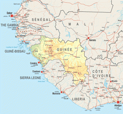
- Land boundaries: 3399 km
- Border countries: Côte d’Ivoire 610 km, Guinea-Bissau 386 km, Liberia 563 km, Mali 858 km, Senegal 330 km, Sierra Leone 652 km
- Coastline: 320 km
- Airports: 16 with paved runways: 4 (2010)
- Railways: 1 185 km
- Roadways: 44 348 km; paved: 4 342 km; unpaved: 40 006 km (2006
- Waterways: 1,300 km (navigable by shallow-draft native craft in the northern part of the Niger system) (2009)
- Ports and terminals: Conakry, Kamsar
Demographic Trends
- Population 2010: 9 982 000
- Projection 2050: 23 006 000
- Population < 15 years: (42.9% * 9 982 000 = 4 282 278)
- Population density: 41/ sq. km
- Urban agglomeration: Conakry (1 653 000 =16%)
- Annual Growth: 2.26% (2005-2010)
- Woman fertility (children per women): 5.45 (2005-2010)
- Median age: 18.3
- Dependency ratio: 132
Migration and Mobility
- Number of emigrants (2010): 532 700 =5.2% of pop
- Number of immigrants (2010): 394 600 = 3.8% of pop
- Top destination countries: Côte d’Ivoire, Senegal, Sierra Leone, The Gambia, Liberia, France, Mali, Spain, the United States, Nigeria
- Refugees within country: 21 500 (2009)
Economic Indicators
- GDP total: USD 11 672 million
- GDP per capita: USD 1131
- Annual Growth: -0.3%
- Average growth (2002-10): 2.5%
- Currency: Guinean franc (GNF)
- Inflation Rate: 4.7% (2009)
- Main Exports: bauxite, alumina, gold, diamonds, coffee, fish, agricultural products
- Main Export Partners: Spain 15.5%, Russia 8.2%, Germany 8.1%, Ireland 6.9%, US 6.7%, Ukraine 6.6%, India 4.6%, Canada 4.3% (2009)
- Main Imports: petroleum products, metals, machinery, transport equipment, textiles, grain and other foodstuffs
- Main Import partners: China 8.6%, Netherlands 6.5%, France 4.2%, UK 4.1% (2009)
- Trade balance: USD -10 million
- Net Foreign Direct Investment inflows: USD 141 million
- Estimated Diaspora Remittances 2009: 1.5% of GDP
- = USD 68 million
- = USD 6.81 per capita
- ODA received: USD 215 million
- =as % of GDP: 1.84%
- =per capita: USD 21.53
- Category: Low income (2011)
- Public Spending on:
- Education as a percentage of total government expenditure (2000-2007): 25.6%
- Health as a percentage of total government expenditure (WHO, 2009): 4.7%
- Military: USD 99.9 million =2.2% of GDP (2004)
- External Debt: USD 3 015 million
- Debt service (as % of Exports 2010e): 12.2%
- Public finance (% of GDP 2009):
- Revenue and grants: 16.7%
- Expenditures and net lending: 25.1%
- Overall balance: -8.4
- IMF Adjustment Programme: yes
- Corruption Perception Index (xx/10): 2 (164/178)
- Index of Economic Freedom (xx/100): 51.7 (137/179)
- WB Doing Business index 2011: 179/183
- Ibrahim African Governance index: 47.8
Food Security
| Global Hunger Index: | 17.3 (IFPRI, 2011) |
| Food supply (kcal per capita/day) | 2 529 |
| Number of people undernourished: | 1.6 millions |
:Percentage of people undernourished: | 17% |
| Child malnutrition, underweight: | - |
| Child malnutrition, stunting: | - |
Land use
| Land area (1 000 ha): | 24 572 |
| Agricultural land area (1 000 ha): | 14 240 |
Arable land (1 000 ha): | 2 400 |
| Permanent crops (1 000 ha): | 690 |
| Pastures (1 000 ha): | 10 700 |
| Irrigated land (1 000 ha): | 95 |
| Share in total water use by |
|
| Forest area (1000 ha): | 6 544 |
Source: FAOStat and FAO Country Profile
Social Indicators
Religion & Ethnicity
- Ethnic Groups : Peuhl 40%, Malinke 30%, Soussou 20%, smaller ethnic groups 10%
- Major Religions: Muslim 85%, Christian 8%, indigenous beliefs 7%
Health
- Life Expectancy: 57.6 (2005-2010)
- Under-five Mortality Rate (per 1000 live births) (2008): 146
- Number of physicians (for 100 000 people) (2004): 5.5
- Hospital Beds (for 10 000 people): 3 (2005)
- Estimated HIV prevalence (2007): 1.6%
Education:
- Adult literacy rate: (% age 15 and above): 38,0% (2008)
- Youth Literacy Rate: 58,7% (2008)
- Net Primary Enrolment Ratio: 1364491 (2008)
- Net Secondary Enrolment Ration: 530705 (2008)
- Tertiary Students: N.A
- University attendance Ration: 9,2% (2008)
ICT & Media:
- Internet Access (per 100 inhabitants)2009: 0.94
- Internet domain: .gn
- International dialing code: 224
- Mobile line (per 100 inhabitants) 2009: 34.65
- Main telephone line (per 100 inhabitants) 2009: 0.22
Basic Services
- Access to electricity 2007: kWh 958 millions
- Water supply coverage 2008: 71% (urban 89%, rural 61%)
- Sanitation coverage2008: 19% (urban 34%, rural 11%)