TogoDownload light PDF version
Overview
Togo was run by President Étienne Eyadéma Gnassingbé for a 38 year period. His son, Faure Gnassingbé Eyadéma became President after the death of his father in 2005 and was re-elected for another five-year term in March 2010, winning with 60.9% of votes. Togo now seems to be slowly transitioning to democracy. It is the fourth largest phosphate producer. It also enjoys high regional demand for its cement and clinker (the main component of industrial cement), and it has recently experienced increases in cotton, cocoa and coffee production.
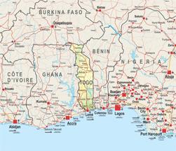
A former German colony, the country’s territory was divided between France and the United Kingdom in 1918; the Western half of Togo extending from Lomé to the mouth of the Volta was integrated into what is currently Ghana. The result is a country made up entirely of border zones (no point in the country is located more than 100 km from a border) that is strongly oriented towards regional trade. Lomé is the only capital in West Africa that is divided by one of its borders. Its regional port is one of the national economy’s major assets. In addition, the Togolese authorities have adopted the free zone concept in all its possible forms in order to maximise the country’s attractiveness and further strengthen its position regionally. Lomé host the headquarters of two major West African development banks – UEMOA’s West African Development Bank (BOAD) and the ECOWAS Bank for Investment and Development (EBID), and it is also the home of the African School for Architecture and Urbanisation (EAMAU).
Institutional Framework
| Government type: | Republic under transition to multiparty democratic rule |
| Constitution: | adopted by public referendum 27 September 1992<
|
| Legal system: | customary law system |
| Administrative division | 5 regions: Centrale, Kara, Maritime, Plateaux, Savanes |
| Executive branch: |
|
| Legislative branch: | unicameral National Assembly (81 seats; members elected by popular vote to serve five-year terms) |
| Judical branch: | Court of Appeal or Cour d'Appel; Supreme Court or Cour Supreme |
| Political parties: |
|
| Suffrage: | 18 years of age; universal |
| Elections: | president elected by popular vote for a five-year term (no term limits); election last held on 4 March 2010 (next to be held in 2015); prime minister appointed by the president |
| Election results: | Faure GNASSINGBE reelected president; percent of vote - Faure GNASSINGBE 60.9%, Jean-Pierre FABRE 33.9%, Yawovi AGBOYIBO 3%, other 2.2% |
| Central bank: | Central Bank of West African States (BCEAO) |
| Military branches: | Togolese Armed Forces (Forces Armées Togolaise, FAT): Ground Forces, Togolese Navy (Marine du Togo), Togolese Air Force (Force Aérienne Togolaise, FAT), National Gendarmerie (2011) |
| Military age and obligations: | 18 years of age for selective compulsory and voluntary military service; 2-year service obligation |
| Membership in regional organisations: | AfDB, AU, ECOWAS, UEMOA, ABV, Cen-sad |
Regional Indicators
| Land boundaries: | 1 647 km |
| Border countries: | Benin 644 km, Burkina Faso 126 km, Ghana 877 km |
| Coastline: | 56 km |
| Airports: | 8, including 2 with paved runways |
| Railways: | 568 km |
| Roadways: | 7 520 km; paved: 2 376 km; unpaved: 5 144 km (2000 |
| Waterways: | 50 km (seasonally navigable by small craft on the Mono River depending on rainfall) (2009) |
| Ports and terminals: | Kpeme, Lomé |
Demographic Trends
Population 2010: 6 028 000
Projection 2050: 11 130 000
Population < 15 years: 2 681 000 (39.6% * 6028000= 2387088)
Population density: 106/ sq. km (2010)
Urban agglomeration: Lomé (1 667 000 =24.6% )
Annual Growth: 2.17 % (2005-2010), 2.04 (2010-2015)
Woman fertility (children per women): 4.30 (2005-2010) > (2010-2015) 3.86
Median age (2010): 19.7
Dependency ratio: 76
Migration and Mobility
Number of emigrants (2010): 368 700 =5.4% of population
Number of immigrants (2010): 185 400 = 2.7% of population
Top destination countries: Nigeria, Côte d’Ivoire, Benin, Burkina Faso, France, Germany, Niger, Gabon, Italy, the United States
Refugees within country: 9 400 (2009)
Economic Indicators
- GDP total: USD 6 289 million (2010)
- GDP per capita: USD 928
- Annual Growth (2009): 3.2
- Average growth (2002-10): 2.5%
- Currency: CFA Franc
- Inflation Rate: 2.9% (2009)
- Main Exports: cotton, phosphates, coffee, cocoa
- Main Export partners: India 13.6%, Benin 12.6%, Ghana 12.5%, Burkina Faso 11.7%, China 8.9%, Nigeria 6.1%, Niger 6%, Malaysia 4.4% (2009)
- Main Imports: machinery and equipment, foodstuffs, petroleum products
- Main import partners: China 17.1%, France 12.9%, Finland 9.9%, Netherlands 5.4%, Belgium 4.5%, Ghana 4.5%, Cote d'Ivoire 4% (2009)
- Trade balance: USD -400 million
- Foreign Direct Investment inflows: USD 50 million (2009)
- Estimated Diaspora Remittances 2009: 10.3% of GDP
- =USD 307 million
- =USD 50.92 per capita
- Total ODA received 2009: USD 499 million
- =as % of GDP: 7.93%
- =per capita: USD 82.78
- Category: Low income (2011)
- Public Spending on:
- • Education as a percentage of total government expenditure (2000-2007): 13.6
- • Health as a percentage of total government expenditure (WHO, 2009): 6.9
- • Military: USD 55.1 million = 1.7% of GDP (2008)
- External Debt: USD 1 740 million (2009)
- Debt Service: 6.1% *exports of goods and services
- Public finance (% of GDP 2009):
- • Revenue and grants: 16.4%
- • Expenditures and net lending: 21.9%
- • Overall balance:-5.5
- IMF Adjustment Programme: yes
- Corruption Perception Index (xx/10): 2.4 (ranked 134/178) in 2010
- Index of Economic Freedom (xx/100): 49.1 (153/179)
- World Bank Doing Business index: 160/183
- Ibrahim African Governance index: 53.0
Food Security
| Global Hunger Index (IFPRI, 2011): | 20.1 |
| Food supply (kcal per capita/day) | 2 146 |
| Number of people undernourished: | 1.8 million |
:Percentage of people undernourished: | 30% |
| Child malnutrition, underweight: | 26% |
| Child malnutrition, stunting: | 24% |
Land use
| Land area (1 000 ha): | 5 439 |
| Agricultural land area (1 000 ha): | 3 380 |
Arable land (1 000 ha): | 2 460 |
| Permanent crops (1 000 ha): | 170 |
| Pastures (1 000 ha): | 1 000 |
| Irrigated land (1 000 ha): | 7 |
| Share in total water use by |
|
| Forest area (1000 ha): | 287 |
Source: FAOStat and FAO Country Profile
Social Indicators
Religion & Ethnicity
- Ethnic Groups: 37 tribes; largest and most important are Ewe, Mina, and Kabre, European and Syrian-Lebanese less than 1%
- Major Religions: Christian 29%, Muslim 20%, indigenous beliefs 51%
Health (UNDP HDR2010)
- Life Expectancy at birth: 62.4 (2005-2010)
- Under-five Mortality Rate (per 1000 live births) (2008): 98
- Number of physicians (for 100 000 people) (2004): 3.7
- Hospital Beds (for 10 000 people): 9 (2005)
- Estimated HIV prevalence (2007): 3,3%
Education: (UNDP HRDR 2010)
- Adult literacy rate: (% age 15 and above): 64,9% (2008)
- Youth Literacy Rate: 83,5% (2008)
- Net Primary Enrolment Ratio: 1 163 902 (2009)
- Net Secondary Enrolment Ration: 4 089 64 (2007)
- Tertiary Students: N.A
- University attendance Ration: 5,3% (2007)
ICT & Media:
- Internet Access (per 100 inhabitants) 2009: 5.38
- Internet domain: .tg
- International dialing code: 228
- Mobile line (per 100 inhabitants) 2009: 33.05
- Main telephone line (per 100 inhabitants) 2009: 2.70
- Access to electricity 2007: kWh 708 millions
- Water supply coverage (2008): 60% (urban 87%, rural 41%)
- Sanitation coverage (2008): 12% (urban 24%, rural 3%)